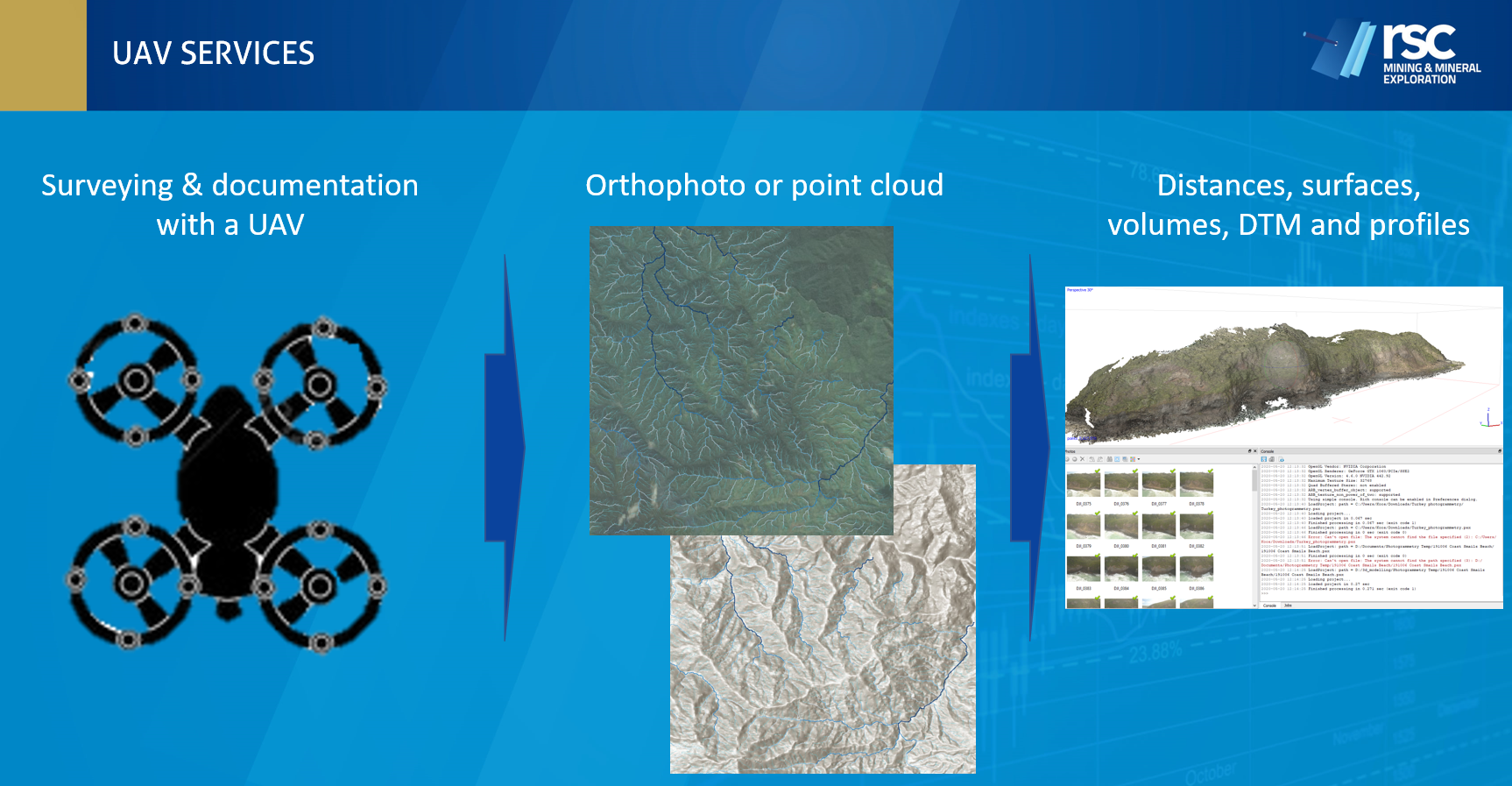
Drone Photogrammetry
Photogrammetric data is an asset on every mining and exploration project. Data resolution depends on the the camera used and the flying height. Average resolutions for Orthomosaic maps range from 5 to 30 cm, and digital terrain model (DTM) resolutions from 30 to 50 cm.
Data processing combines photos taken under a 70-degree angle and correlates comparable pixels with each other, generating images in the visible spectrum that contain the same point on the ground from multiple vantage points. This method is ideal for 2D maps and low-resolution 3D terrain models. Data accuracy and precision are highly dependent on the type of GPS or DGPS system used on the drone, or the use of ground-control points to correct deviations.

Drone LiDAR
LiDAR is powerful remote scanning technology that calculates distance instantly. This technology means point clouds are available within minutes rather than hours after landing. LiDAR also needs only one return from a surface to make it present in the point cloud. As a result, it is very effective at penetrating even the densest of canopy coverage. We’ve found that small objects, such as powerlines are also very accurately represented. Where good lighting is essential for photogrammetry, LiDAR has its own inbuilt laser light source, meaning you can collect data in low light and harsh weather conditions.
Our experts are here to help
Our pilots have over five years of experience using UAV instruments in mining and exploration settings, especially in remote, challenging environments. Let us guide you through interpreting aerial data, assisting with workflow generation through to the final crunch of data analytics.