
Satellite remote-sensing maps
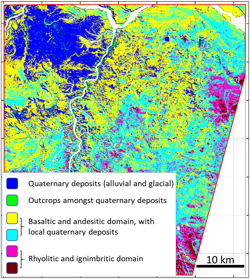
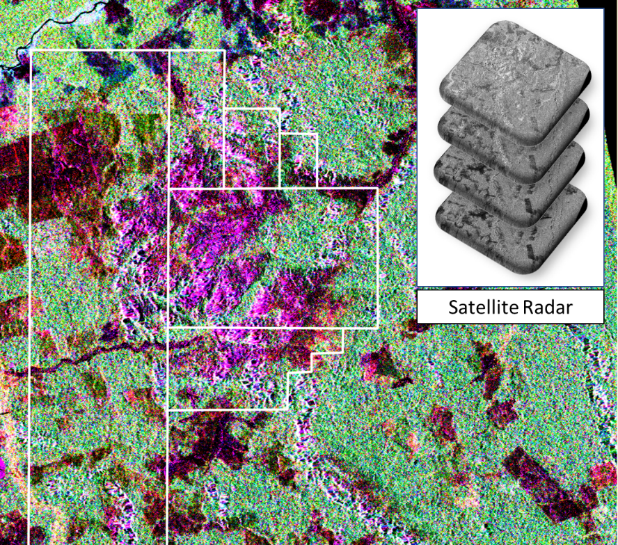
High-resolution satellite photos can be used for planning fieldwork, as outlined in our section on the Outcrop Finder. However, spectral data, collected by satellites, can also be used to create regolith, mineral or even geology maps in areas of fresh rock. Two examples are shown here: one that uses synthetic aperture radar data to investigate land cover associated with mineralisation (see figure on the left), and the second uses spectral data to map lithology using training points and spectral unmixing (see figure on the right).
Synthetic aperture radar data, combined to investigate land cover associated with mineralisation in a heavily vegetated area of equatorial farmland, based on the character of radar scattering. Areas coloured purple relate to the region hosting mineralised stratigraphy.
Recognition of lithology using both training points (field observation, n = 452 over less than 5% of the study area) and spectral unmixing (mafic, intermediate and felsic index).