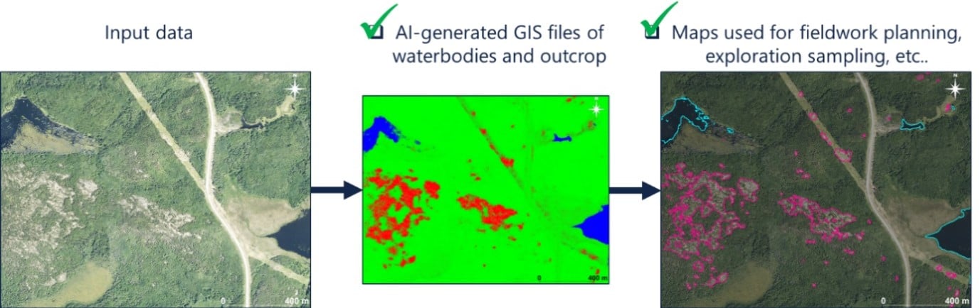

Outcrop Finder
This is a tool that helps minimise the often-painstaking work of locating outcrop for geologists to map and sample. It uses available satellite imagery and topographic information to predict where bedrock exposures are most likely to be found.
Originally designed for geologists working in the remote, glaciated, boreal forest geology of Canada, this tool has applications for optimising mapping and sampling campaigns in regolith-dominated terranes.
Our Outcrop Finder scrutinises and interprets detailed analyses of terrain images to identify likely outcrop areas. Once enough training points are identified (e.g. 100), Outcrop Finder automates the process and generates outcrop probability maps for large areas in minutes.
Outcrop Finder input and outputs.